Monster mountain discovered lurking in depths of Pacific Ocean
Published 7 Sep, 2014 12:09 | Updated 9 Sep, 2014 07:02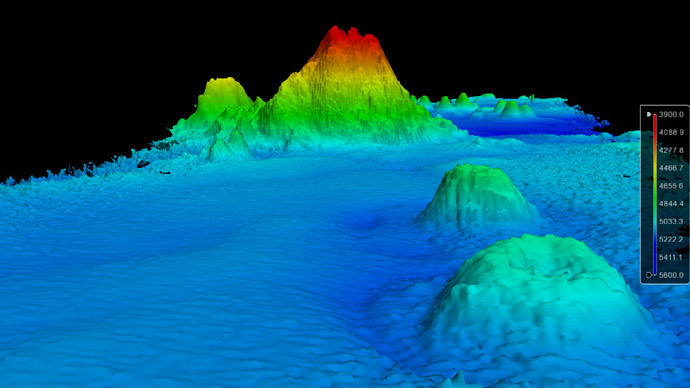
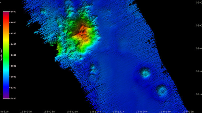
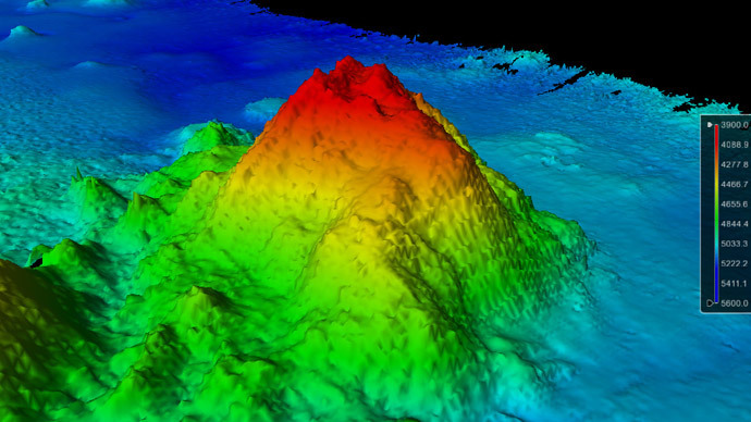
Scientists have uncovered a giant mountain in the Pacific Ocean, with the summit of the seamount rising 1,100 meters from the 5,100-meter-deep ocean floor. The discovery was made around 2,600 kilometers south of Hawaii.
It was uncovered in mid-August by a research team, which was led by NOAA and University of New Hampshire scientist, James Gardner. The team was aiming to try and map the outer limits of the US continental shelf.
Gardner was surveying one of least known parts of the central Pacific Ocean, which was around 300 kilometers south east of uninhabited Jarvis Island. However, the seamount, which has yet to be named, appeared “out of the blue.”
“These seamounts are very common, but we don’t know about them because most of the places that we go out and map have never been mapped before,” the researcher said in a press release on September 2.
Since only low-resolution satellite data exists for most of the Earth’s seafloor, many seamounts of this size do not show up on satellite. However, advanced multibeam echosounder missions like this one can resolve them.
“Satellites just can’t see these features and we can,” Gardner added.
For now it isn’t known whether the seamount could have any human use. It is too deep (its summit lies nearly 4,000 meters beneath the surface of the ocean) to be a navigation hazard or to provide rich fisheries.
“It’s probably 100 million years old,” Gardner says, “and it might have something in it we may be interested in 100 years from now.”
Seamounts are formed due to volcanic activity and are normally found near plate boundaries. However, they can also be located in the middle of plates where there are particular hot spot areas.
While Mount Everest may hold the record for the highest elevation on land, the tallest mountain in the world is actually a seamount. Hawaii’s Mauna Kea, a dormant volcano, is 10,200 meters tall when measured from base to peak; Everest is 8,850 meters. Only 4,000 meters of Mauna Kea is above sea level.