Earth at night: NASA releases stunning images of planet under moonlight (VIDEO)
Published 13 Apr, 2017 13:15 | Updated 13 Apr, 2017 14:53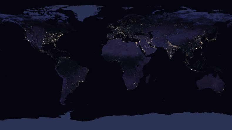
NASA has released incredible new satellite images of Earth at night, lit by billions of lights from human activity. The images are the first of their kind in five years, offering researchers an opportunity to see how cities are changing.
Images of Earth at night, also known as ‘Night Lights,’ have been produced every decade for 25 years. A source of curiosity since they first appeared, they’ve been used for all manner of purposes, including research in the fields of economics, social science and environmental research.
The first new global Night Light since 2012, this night-time look at our planet, which researchers call the Black Marble, gives an invaluable perspective on human activity around the globe.
It shows the biggest cities on Earth lit up like powerful beacons in a sea of darkness, with motorways and other large road systems reaching out like veins and arteries. In densely populated areas, like the east coast of America or western Europe, the clusters of light spread out like a rash.
READ MORE: Black hole cam: Astronomers launch mission to snap first ever image of star eater
“By studying Earth at night, researchers can investigate how cities expand, monitor light intensity to estimate energy use and economic activity, and aid in disaster response,” NASA said.
The data comes from NASA’s Visible Infrared Imaging Radiometer Suite (VIIRS). The instrument captures visible and infrared light, allowing researchers to glimpse the Earth as it looks to astronauts peering out of the International Space Station.
The new map took several months to create. Scientists had to filter out clouds, moonlight, airglow, and other interfering features to create the image. The biggest challenge was posed by the phases of the moon, which constantly varies the amount of light shining on Earth.
The new maps were produced with data from all months of each year. The team wrote code that picked the clearest night views each month, ultimately combining moonlight-free and moonlight-corrected data.
Scientists are on the verge of being able to provide daily, high-definition views of Earth at night. The data is expected to be released to the science community later this year, NASA said in a statement.