Indian navigation satellite soars into orbit, step closer to own GPS-like system
Published 5 Apr, 2014 16:30 | Updated 6 Apr, 2014 09:15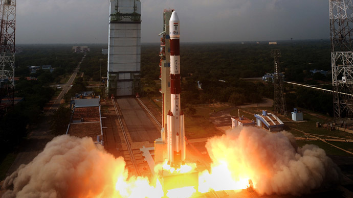
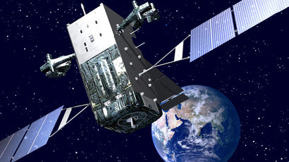
The Indian Space Research Organization successfully launched its IRNSS-1B navigation satellite into space – the second of seven satellites which are bringing India steps closer to providing an alternative to US-owned global positioning systems.
The Indian Regional Navigation Satellite System-1B was launched
with the country’s Polar Satellite Launch Vehicle (PSLV) as it
set off from the Satish Dhawan Space Centre at 11:44 pm UTC on
Friday. IRNSS-1A is already in orbit. India expects the remaining
satellites – five of the seven – to have joined them by mid-2015.
"The launch was successful and met predefined targets,"
said ISRO chairman K Radhakrishnan. IRNSS-1B went into orbit a
mere minute into launch after being separated from the PSLV.
The targets were a perigee (closest distance to earth) of 284km –
with the satellite achieving 283- and an apogee (maximum distance
from earth) of 20,650 km – of which the satellite was just 20km
short.
The PSLV did not directly transfer satellites into a
geosynchronous orbit but placed them in an interim sub
Geosynchronous Transfer Orbit (sub-GTO) – an elliptic orbit with
a high point of 20,611km, a low point of 283.km and an
inclination of 19.2 degrees relative to the equator.
"We will be launching two more satellites - IRNSS 1C and
IRNSS 1D - this year. We will launch another three IRNSS
satellites in the beginning of 2015. By mid 2015 all the seven
satellites will be in orbit," the ISRO chairman stated.
When completed, the Indian Regional Navigation Satellite System
(IRNSS) will provide navigational GPS services for civilian and
defense purposes in the country and its range will stretch some
1,500 km beyond its borders. IRNSS services will only be
available to India.
“In contrast to global positioning systems (GPS), ours is a
regional system. We will have three geostationary satellites and
four satellites on an inclined orbit, which will provide
navigation coverage to a zone stretching 1,500 km around India’s
borders,” the ISRO chairman said.
The IRNSS is expected to cost $239 million, according to
Spacenews. This will also involve 21 ranging stations on the
ground.
The PSLV used in the launch was on its 26th flight, and its 25th
consecutive success. However, it was only the sixth occasion on
which it was flying in an ‘XL’ configuration – a method which
uses additional propellant in the PSLV’s Solid Rocket Boosters,
increases payload capacity and enables higher orbits.
XL was used for the first IRNSS satellite IRNSS-1A, alongside
Chandrayaan-1 and the Mars orbiter mission.