Magnitude 5.9 earthquake strikes offshore Indonesia - USGS
Published 15 Apr, 2018 19:57 | Updated 16 Apr, 2018 08:12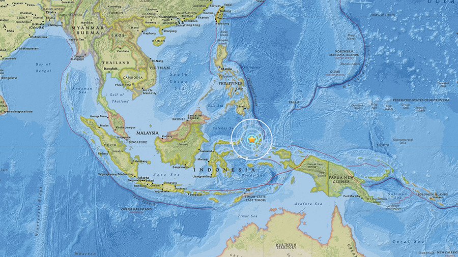
An earthquake measuring 5.9 on the richter scale struck offshore Indonesia in the Moluccas sea at approximately 2:30 am local time (1930 GMT) Monday according to the US Geological Survey (USGS).
The quake struck 53 miles (85.3 km) northwest of Ternate at a depth of 22.7 miles (36.5 km) below the seabed, a relatively shallow depth, making it potentially far more dangerous. No tsunami warning has been issued thus far. The USGS initially reported it as a 6.1 magnitude earthquake before downgrading it to a 5.9 soon after.
Indonesia is the world’s fourth most populous country with a total of 291 million people spread across the country's 13 islands. The country is located in a highly seismically active part of the world known as the Pacific Ring of Fire.
A 5.9 earthquake is considered moderate but would cause significant damage had it occurred on land.
Think your friends would be interested? Share this story!