6.2 magnitude earthquake strikes southwest of Samoa
Published 8 Mar, 2016 06:02 | Updated 8 Mar, 2016 07:29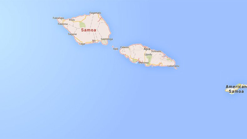
A 6.2 magnitude earthquake has struck off the Samoa islands, Geoscience Australia and the US Geological Survey (USGS) reported, adding that the epicenter of the quake is about 200km from Apia, the capital and largest city of the island country.
Apia has about 37,000 residents.
The earthquake depth is 29.8 km, USGS said. The European-Mediterranean Seismological Centre (EMSC) put the depth of the earthquake at 2km.
Mag 6.2. Samoa Islands Region, 08 Mar 2016 16:36 (AEDT). Lat/Lon 14.875S, 173.047W Depth 0km. Info is preliminary.
— EarthquakesGA (@EarthquakesGA) March 8, 2016
According to the most recent USGS estimate, the magnitude of the quake is 5.8 and it took place just 96km from the town of Hihifo in Tonga.
Map of epicenter of #quake off #Samoa. pic.twitter.com/SmHEE1dbro
— Steven L Herman (@W7VOA) March 8, 2016
There have not been any reports of injuries or damage, and no tsunami warning has been issued.
The part of South Pacific Ocean where Tonga and Samoa are located is considered to be one of the most seismically active areas of the world due to high rates of convergence between the Australia and Pacific plates, the USGS said.