First colorful pic of Africa & Europe from EU second-gen weather sat (PHOTO)
Published 5 Aug, 2015 06:15 | Updated 5 Aug, 2015 06:22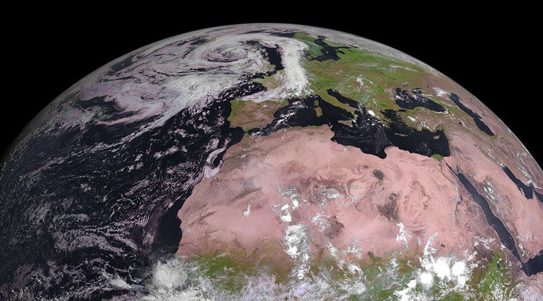
The MSG-4 weather satellite has started beaming down pictures of earth from its geostationary orbit, with the first image released on Tuesday showing Africa and Europe.
Detailed images from satellites, which are placed in a stationary orbit over a single spot, are used to monitor the evolution of weather systems. A series of pictures can be combined into a time-lapse animation.
The fourth Meteosat Second Generation (MSG) is the final satellite in the European weather monitoring constellation. It was launched last month and handed over from the European Space Agency to the meteorological service EUMETSAT on July 26 after it was moved into its final orbit.
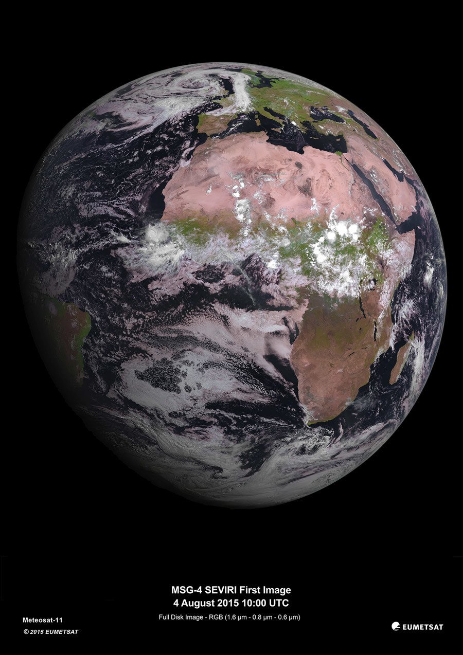
The satellite is currently undergoing a seven-month commissioning process and will eventually be renamed Meteosat-11 and go into hibernation until it is needed as backup for one of the other Meteosat constellation satellites.
Previous MSG-series satellites – Meteosat 7, 8 and 10 – are currently online sending high-resolution images of Europe, Africa and parts of the Indian and Atlantic Oceans every 15 minutes.